Thursday, September 16, 2010

Bamfield BC


22 - 28 August 2010


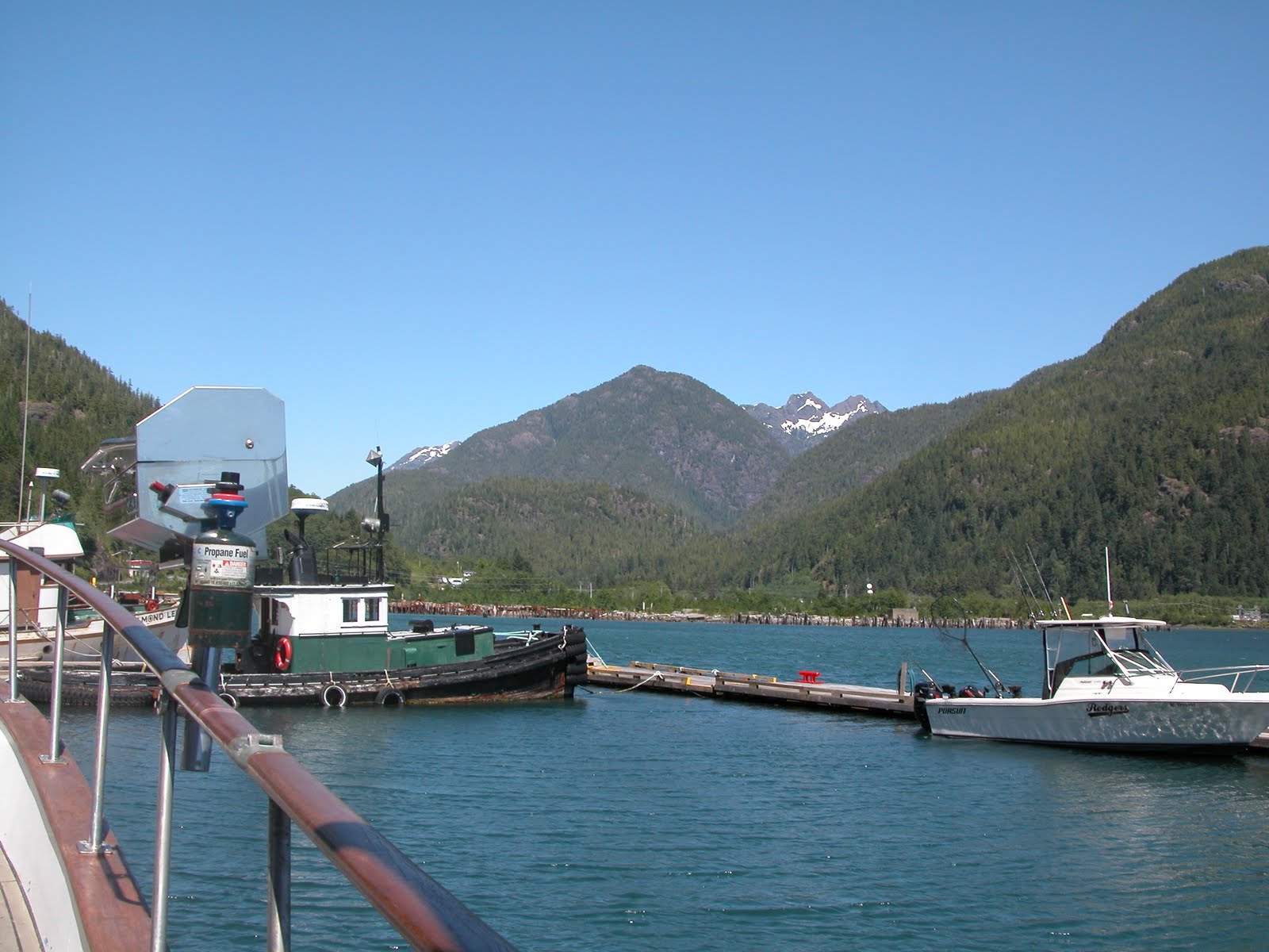
Bamfield has been my favorite village that we have happened across on our journey. It is touted as the Venice of Vancouver Island, and for good reason. The towns "main street" is the inlet waterway that divides the east and west sides of the village. There are no roads connecting the two halves, everyone putts back and forth across the waterway in every conceivable floating contraption imaginable. We tied up at the public dock for most of our stay in Bamfield. A couple floated their dock over to the wharf to load it with lumber to bring across the waterway. A young firl peddled her hydrobike up alongside of us. A bicycle that floats! The water taxi ferried backpackers, lodgers, packages and pets, back and forth across the main street. A sight to watch.


The houses and shops on the west side use a boardwalk along the waterfront as the main roadway, although there were gravel roads leading to homes on the hillside, but these roads were more of a suggestion of a road. Any vehicles on that side of the town had to be floated over by a car hauler - we saw several going back and forth during our stay.


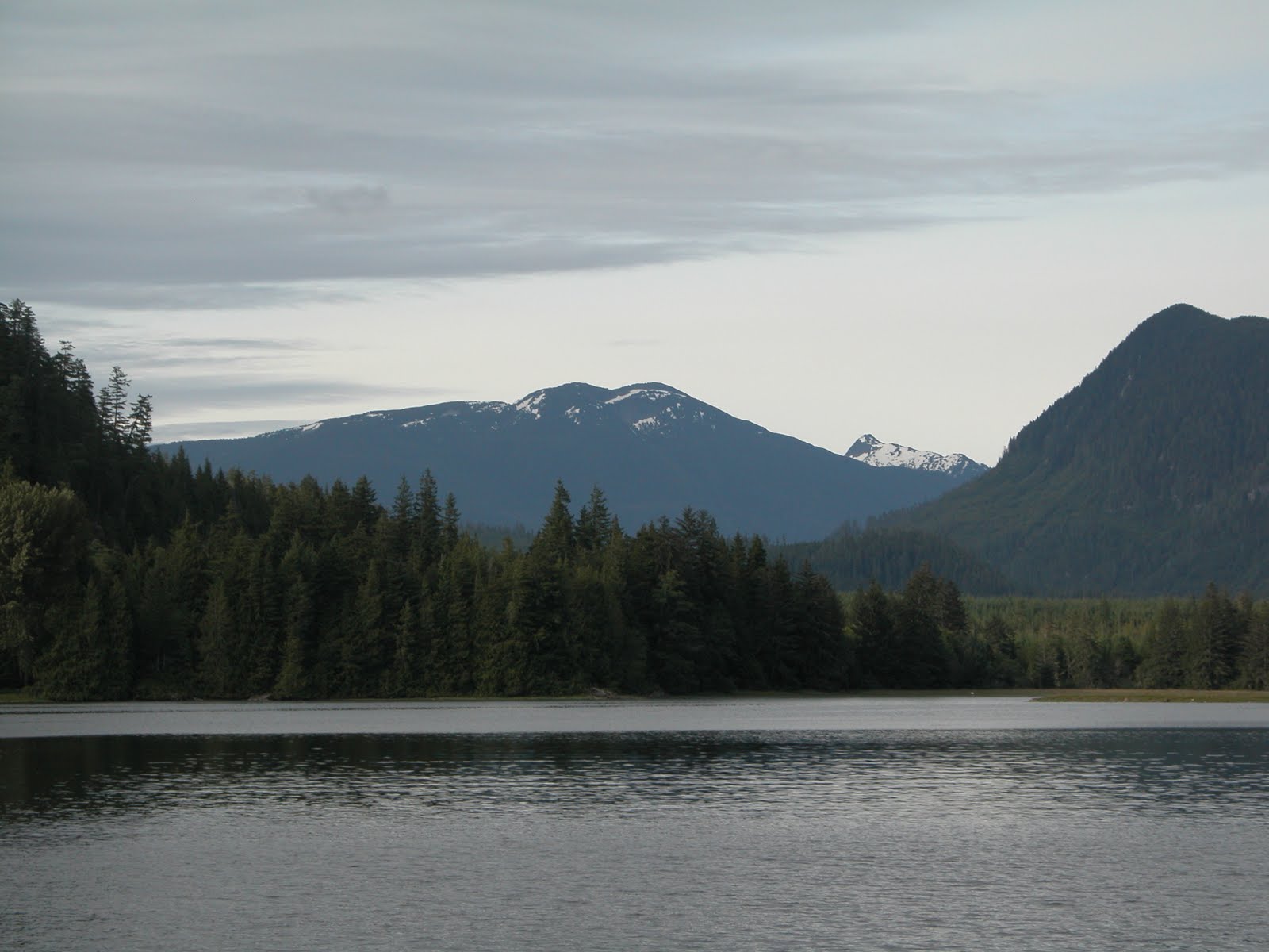
Matilda and I hiked to Brady Beach one morning while Dave went out fishing. We followed the boardwalk up to one of the gravel roads and just followed the sign posts. It wasn't a long hike but meandered over the hill to the west side which faced the Trevor Channel. We packed a picnic breakfast for our trek. It was a wonderful spot, full of seashells and sea glass. It was a morning well spent. We med a local couple on our outing - the resident nurse that has worked at the medical clinic for 25 years. On our way back to the dock, where Dave was to pick us up, we walked along the boardwalk where there stood quaint shops, cottages and even the local cat house! A small village for cats! Matilda enjoyed that immensely!


The salmon hadn't really started their run into Port Alberni yet. A few folks snagged a few, but most had been caught off the oast in the ocean and not in the Sound. On our trip back to Ucluelet we ventured approximately 32 miles offshore where Dave was able to catch 2 very nice King Salmon in short order!


Tuesday, September 7, 2010

To Poetts Nook

12 - 21 August 2010

On our first day out, we traveled leisurely to the Pinkertons (inside the Barkley). We motored around the islands insearch of the perfect anchorage, however the ones that piqued our interest were taken. We crossed the passage to Nettle Island, which is a "U" shaped island and found a comfy anchorage within the "U" of the island. Dave crabbed, while I gathered oysters from the shore and rowed around the small islets. A couple of curious racoons eyed me from the rock ledge that they were sitting on.


We had the cove to ourselves until nightfall, when another trawler joined us. They left at first light. We left shortly afterwards...Dave was anxious to hit fishing territory and to do more exploring.

From Nettle Island we traveled the Imperial Eagle Channel towards Fleming Island. Fleming Island (and Tzartus Island, which is adjacent) are known for their sea caves. Some of the caves can be accessed by small boat or kayaks, others are higher up on the shore. Some of these caves are burial grounds for the native people who lived on the islands in an earlier age. Stories tell of spelunkers exploring caves and finding the remains of these earlier people. After finding a sevure anchorage at Poetts Nook, we took the AquaSport through Robbers Passage and explored the sea caves on the southwestern side of Tzartus Island and the western side of Fleming Island. The caves that I had wished to explore by land were difficult to reach by the AquaSort, so I had to accept the view from the water's edge. Dave dropped Matilda and I off at a secluded beach to get some "land time" while he went fishing. We collected shells and looked for moon snails. We had the beach, and perhaps the whole island to ourselves...there was not a single footprint to be found, save our own.


Poetts Nook is a haven for the boaters that travel from around Vancouver Island (and the States). It caters to small fishing boats and RVers that trailer their vehicles from Port Alberni over 50 miles of gravel logging road. It is a destination spot for sports fishermen (and women). We anchored at the head of the bay and called Poetts Nook home for about a week.


Tilly and I made several excursions to shore where we found a plethora of pickleweed growing in the salt marsh. I collected several batches, some to eat fresh and the rest I canned. Dave went fishing on several occasions, bringing home ling cod, bass, spotted shrimp and crab. We have eatten quite well on our little adventure.

Ucluelet - Part II


5 - 11 August 2010


Our journey to Ucluelet was simple and straight forward. We followed the northwest shore of Vancouver Island southwest to Ucluelet inlet. We originally anchored in the same location as before, however after several days at anchor we were sitting in our salon, listening to an audiobook (an Agatha Christie mystery, I believe), when I happened to look up and notice that objects on shore (as well as, other boats) didn't seem to be where I had last seen them. We were dragging anchor and the winds and current were carrying us farther into the inlet and closer to a dock and other boats. We started up the engines, pulled up the anchor, and found a solitary location on the norhtern shore of the inlet. It was a much better anchorage, boat traffic in and out of the marina and across the inlet was minimized here. We also had an enjoyabley entertaining neighbor...BooBoo, a black bear that typically would grace us with his presence several times a day. Wildlife tour groups would motor by in boats when BooBoo was out, and a few crab fishermen would putt by to check their pots, but otherwise it was a very private anchorage with a good muddy bottom.


Dave took the AquaSport out to the ocean to go fishing. Matilda and I held down the fort, keeping BooBoo company. Dave arrived early in the afternoon with a very nice halibut for my birthday dinner. What a delicious treat! We had also been quite successful in the crab department, so enjoyed several meals of that, as well. Our next stop was the Pinkertons and the inner islands that make up the group of islands known as The Broken Group.

The Pipestem Revisited


3 - 5 August 2010


We spent the month of August exploring the Barkley Sound. Unfortunately, wifi was not available (or was terribly expensive) at most of the locations that we visited, so I am finally playing "catch up".


After our time at Effingham Bay we trekked back to the Pipestem in a light fog. Regardless of the fog, we were able to spot whales as we left Effingham Bay. Our hope was to find sunshine the further inland that we traveled...and we did! We also found that our delightful anchorage that we had on our last visit was awating our return. We quickly set anchor and stern tied to shore to relax in the sunshine for the remainder of the day. The following morning, at low tide, I rowed the tender to the point at the head of our anchorage and collected oysters and pickleweed (my new favorite wild veggie). I felt like I was being watched as I worked, and I was...a bald eagle, perched on a limb above me - scrutinized my every move. In the afternoon, at high tide, Dave and I took the AquaSport up to Lucky Creek to view the waterfalls. This time I had my camera with me so was able to take photos. The next day, Dave made a scuba dive - for fun. He was hoping to find sea cucumbers and urchins, but alas, there wer none to be found in our little cove.

Wednesday, August 4, 2010

Back to the Barkley!


Effingham Bay - 31 July/2 August 2010

After a short jaunt back to the States to conduct business and reprovision, we are back in the Barkleys! I feel like we have come home! On our return the whales greeted us. This time around I was actually able to photograph them! Fishing boats were a plenty...all the way up from the Port of San Juan. Hopefully that is an auspicious sign for us and our fishing endeavors.

There were 9 boats at anchor in Effingham Bay, with room for many more. By nightfall the number increased to 14. We were unable to secure the prime spot in the bay's "thumb" (were the trailhead to the ancient Indian Village is), but were close enough to row to it. After a long day of travel - we rested. On the following day I ventured to shore to visit the village grounds.

As I rowed towards the trailhead, I noticed a DeFever that hailed from none other than Florence, Oregon (my home town). The owners of the vessel were on their aft deck, so I rowed over to chat with them. Chris and Dave. Of course they had heard of the Braley's...they originally were from Reedsport and had known the Prozialeck name, as well. Time to break out in "it's a small world after all"!

The trail is uniquely marked. No signs or placards - just debris. A crab float tied to a tree here, an old shoe overturned on a sick there. It was a fun hike, not long, but winding and rugged. The trail wound through a dense old growth forest to the eastern shore of Effingham Island. It is hard to put the village site into accurate words. There are no buildings or foundations to be seen. Rather, the village is "felt". Just off of the beach, nestled amoungst the trees, there are areas of ground that are flat. A berm runs behind the open spaces, which is were the villagers of thousands of years ago, placed their molusk shells. this is now covered in a dense moss. I found batches of hedge nettle and mustard greens which resembles a garden left to its own devices. And while walking the grounds I could smell mint, but was never able to place its source, though it was rather strong. The guidebook mentioned that the village had an "eerie" feeling, although I would say that it had a more mystically haunted feel.

After my exploration of the village. I wandered down to the shore. The cove was encompassed by rocks with manificent tidepools. I could fully understand why its earlier inhabitants had chosen the spot. Closer into shore there were boulders. I hopped from boulder to boulder and found pockets of sand that was covered in small sea shells. I have never seen such a bounty of color and variety on a West Coast beach. I had brought a baggie to collect "treasures'. After an hour or so, engrossed in my task, i began the trek home.

Tuesday, July 27, 2010

The Barkley Sound

20 - 24 July 2010

Fog has been infiltrating the inlets and bays. Most of it has burned off by late afternoon, but it makes traveling the inside passages and inlets a bit treacherous. We opted to head out to sea. Visibility was at best 3 miles and at worse 1/2 mile, but still preferable to what we could see on the shore - like a shroud hanging over the land. Seas were calm with very little wind as we made our way to the Barkley. The whales decided to travel along with us on this trip, as well. I thought that a rock pinnacle was off our port side, when it was a whale spy-hopping. Then along our starboard side - right NEXT to us - a giant humpback came out of the water. We could see his entire head and back out of the water. The fog was a blessing! We would have missed it all had the skies been clear...

We decided to skip the city of Tofino, a good sized town on the Central Vancouver Coast, and head to the port town of Ucluelet (pronounced You-Clue-Let) on the north end of the Barkley sound. We made for Spring Cove, at the mouth of the inlet. Several homes dotted the shoreline, but it was still quite private. Dave ventured into town and the marina the next morning, and came back to pull up anchor and resettle at the end of the inlet, across from the marina. Once we were re-anchored, I noticed that our friends from Hot Springs Cove (Bob & Kris) were anchored off our starboard bow. They putted over in their tender and kidnapped me for a hike to Amphitrite Point. It was an enjoyable walk with views of the rock infested shoreline, although the fog was drifting in and out of the point, the trip was a beautiful one. The change from being on the boat to being on land seems to make land all the more precious to me. We planned to meet up at Pipestem Inlet the next day for Oysterpalooza. An adventure of oyster gathering, and oyster feasting...

We pulled anchor early the following morning and headed into the northern corner of the Barkley Sound. It was foggy along the outlying coastline, but inland the sun shone bright. We found a snug cove at the mouth of the Pipestem Inlet and set anchor. I rowed the tender to shore with our stern line and tied it to a tree. We had 2 wonderfully restful nights at anchor. There were a few sailboats across the cove from us, but it was a very private and serene little cove. The Luna arrived later in the afternoon, and the four of us set out to explore Lucky Creek. The creek meanders through meadows and wood to a storybook waterfall. I climbed u[ the rock face of the lower fall to see the pools above, then scurried back down the rocks and into the boat. The trip can only be made at high tide (or you will hit bottom in the shallower sections of the stream). We made it out successfully and then headed up the Pipestem into a small lagoon that was awash in oysters! We filled our buckets with oysters, and I filled my sack full of pickleweed (which I found on the shore), and set off to prepare our feast. the party was held on the Luna; a magnificent 47 foot sailboat. I was amazed at the utilization of space that she had. A wonderfully comfortable home. Another great evening spent with friends...thank you, Bob & Kris for your hospitality.

The following day we headed towards the Broken Group; an assortment of islands in the center of the Barkley. The fog thickened as we journeyed down the channel. Thank goodness for chartplotters and GPS!!! We entered Effingham Island from the southwesterly side to bypass the multitude of rocks from the lee side. Not exactly and enjoyable day on the water - traveling through fog is not one of my favorite things - a bit disorienting, but we made it to the island to find the sun breaking through and the fog lifting. We found a tidy nook to anchor in at Effingham Bay and stern tied to the shore. I thing that Dave just likes to watch me row and scurry up and down the rock ledges...A comfortable anchorage with an outstanding view of the sunset.

There is much in the Barkley that we wish to come back to explore, but duty calls and we must return to the states to attend to business. Afterwards it is our hope to return and remain for the summer. There are so many things tucked away in each and every corner of this great island. One could spend the rest of their lives exploring its gems and never tire of it.

Sunday, July 25, 2010

Hot Springs Cove


17 - 20 July 2010

After having a thoroughly enjoyable stay in Tahsis, we ventured out to the mouth of the sound to Friendly Cove. It was a peaceful morning as we cruised the passage heading back towards the Pacific Ocean. Friendly Cove was reported to have good anchorage. We arrived in the late morning and anchored. Tilly and I rowed the tender to shore. There was a nice beach to walk, trails around the head, and an old Catholic Church and native Indian graveyard to explore. the tide was changing, so I didn't want to leave our dinghy unattended on the beach for too long, so we headed back to the Sea Crest after an hour and a half or so. Dave had listened to the weather report while we were gone and the winds were to pick up in the evening. We were just a half days run from Hot Springs Cove, with better protection from the elements there. We pulled up anchor and headed out into the bay.

We traveled in good company. There were several pods of whales that we sited on our way to the Hot Springs. They put on a good show for us.

Hot Springs Cove has been a special treat for boaters. Before the intoduction of modern tranportation to the area (water taxis and sea planes from the city of Tofino, BC) the only folks who took of the pleasures of the baths were local villagers and traveling mariners. Regardless of its current "tourist" status, the Hot Springs are a remarkably pristine and sacred spot. We made several trips in to luxuriate in the waters. The hike is approximately 2 km of boardwalk - with quite a few steps. The trail traverses an old growth forest, and the trees are as much a joy to take in as the baths themselves.


As one enters the Hot Springs, you cross a bridge and see where the water exits the earth. The water is approximately degrees Celsius (122 degs. F). There is a small waterfall that brings the wonderful liquid to the rocky pools below, and to a comfortable bathing temperature. From my shower, I could view the mouth of the inlet and the bay. Heaven on earth! Our first trip to the springs, we had the entire place to ourselves for over and hour. As we hiked back to the dock we met over 20 people heading in to bathe. Being morning people does have it's perks!


In the afternoon, Dave and I took the AquaSport out to the reef to fish. We explored the rocks coves to the south of the hot springs. We caught (and released) a few small sole, but nothing to write home about. We headed to the mouth of Hot Springs Cove, alongside the reef and no sooner had we got a line down, we were pulling up fish! It was one of the finest fishing trips that I have experienced. At the finale, Dave decided that he wanted to get the video camera out and make a fishing documentary. I was to show the world how easy it is to catch fish. In short order, while the tape was roling, I landed one rockfish...then the big Daddy Black Sea Bass. This guy was a MONSTER! I was afraid to hold him up for the camera, for fear he'd take my arm off! When I had pulled him into the boat he had coughed up a large herring which he had inhaled whole!


Upon our return to the Sea Crest - preparing to clean our haul - a couple from a sailboat (Luna), at anchor nearby, kayaked over. We spent the evening with Bob & Kris. They brought over beverages, salad, and an assortment of goodies for hamburgers. We fired up the grill and pulled out a package of buffalo burger. A thoroughly enjoyable day, and evening! Cruisers, whether by sail or power, are intriguing folks...we have met some amazing people on this trip, in the most remote of locations.


The following morning, we made our pilgrimage to the Hot Springs at 7 am. However, on this occasion, there were people who arrived before us . We met a charming family, who shared our pool with us, David, Jeff and Emily. This place had become an annual retreat for their family reunion.


We had spent several glorious days in Hot Springs Cove, and hated to leave this little slice of heaven, but the call to explore beckons...

Friday, July 16, 2010

Kyuquot Sound - Tahsis


14 -16 July 2010

We left our home in Browning Inlet today. The early morning weather report called for a calm morning, we watched a neighboring sailboat down the inlet pull up anchor and head out, and we followed suit. The ocean pushed us southwards towards the Kyuquot Sound and we acquiesced.

The west side of Vancouver Island is extremely rugged and isolated. There are few towns here. No cell phone towers, and roads are unheard of (and not seen, either). The coastline is broken into segments by large bays and inlets that seem to be around every point. We see boats...lots of boats, large and small. The small ones are trailered from the east side of the island by sportsfishermen. Sailboats dot the waterways. They are more like us in their tastes. They travel slowly and prefer anchoring in scenic coves to the hub-bub of a marina. Yachts, both large and small, show themselves in our remote anchorages when the weather becomes less than amiable.

We anchored in Queens's Cove just at the entrance to Esperanza Inlet. There are small houses on the shore (that we later learn belong to a fishing camp), but they are vacant. It was a quiet night. We swayed on the hook a bit in the wind, but our anchor held firm. The morning is foggy and calm. I had never imagined that I would ever see a tidal waterfall, but here it is! When we had pulled into the cove at high tide, the top of the waterfall was equal to that of our cove. At low water it all came tumbling down...We plan to venture further into the inlet, which traverses behind Nootka Island, saving us a trip out to open water for a time. There are a few small towns inside the passage so our hope is to find civilization...catch up on business and let the world know that we are alive and well. We found a simple civilization here in Tahsis. And yet, we are still on the fringe...This is the most delightful place I believe that I have ever been to! Altho the town has dwindled from 3000 residents to a mere 300. It still has a culture and European flare all it's own. The winds had come down from the mountains to the east our first day in...then from the coast (west)...now there is a calm. Of all of the marina's that we have stopped in from our travels from southern California...this is hands down my favorite! (sorry Santa Barbara...)

Thursday, July 15, 2010

Quatsino Sound - Browning Inlet


7 - 14 July 2010

We left the sanctuary of Sea Otter Cove early in the morning to venture back out into the great Pacific Ocean. However, today's journey was much more accomodating. The winds were moderate and the sea was at our back...we had only about 20 nautical miles to travel to reach our destination of Quatsino Sound. If you like remote wilderness with absolutely NO prresumption of civilization...you will LOVE it here! Our journey along the coastline was stressfree (although, I was still feeling a bit peeky). The land is old. You can tell that the land is old by the shape of her hills...they are not full or jagged...they are rounded and worn down (like most good women!) But they are a lovely site to behold. there is life there...as we entered the Quatsino Sound, and rounded the lighthouse, we saw several humback whales breach...flukes waving majestically in the air as they descended. A brilliant dislay - unfortunately, my photography skills are not so brilliant.

Within a 45 minute period, besides whale there were sea otters, seals, eagles soaring overhead and huge fish jumping out of the sea! We followed Browning Inlet, which is more like a riverboat cruise than an ocean voyage. A svelte waterway that meanders into the wilderness. There we found the perfect anchorage; a small cove within the inlet. By first light, a black bear was spotted on the opposite shore. During our stay at Browning Inlet, it would be our morning ritual to watch the black bears lumber upon the shore: overturning rocks, looking for tasty tidbits, and continue on their way.

On our first day in Browning Inlet we were in the full throws of summer...a slight breeze, 85 desgres (90+ in our salon)...a glorious day. Matilda and I made several excursions to shore and explored our little cove. The following day was less brillian, but as thoroughly enjoyable. I rowed our tender to a low tide to collect littleneck clams (steamer clams)...hard work, but well worth the the effort. Afterwards, it was time to replenish our stores...I needed yogurt and more bread, so it became yogurt and bread making day...as it began to sprinkle outside, I knew that the timing was perfect!

A storm was moving in...the skies have clouded over and reports are that the winds will be increasing. We are snug in our private cove, and all is well. There are lots of places to explore in the Quatsino Sound, so all is not lost...I had often heard the phrase "this is God's Country", referring to the Oregon region, but I beg to differ, after this journey I now know that THIS IS GOD'S COUNTRY! Perhaps, God is a Canadian, eh?

Go West!!!


6 July 2010

Another impromtu adventure out at sea...the plan was (originally) that we were to cross the Queen Charlotte Sound early in the am to end up at Rivers Inlet (or nearby). However, plans DO change...

Instead we followed the north end of Vancouver Island all the way around from east to west. A totally isolated part of the island...no towns...no homes...nothing! I like it! Now...in our Waggoner's Guidebook they tell of making the trek, but the wife had the good sense to fly home before it started and let here "fool" husband do the trip with his buddies (although, from the guidebook, it sounds like they had the time of their lives). If I had only known what kind of ride I was in for!!! The Goletas Channel was beautiful! We passed Duval Island (not spelled the familieal way, but close)...great spot out of Port Hardy. From the boat, while cruising by, I could see Indian Pictographs on the rock cliffs. We saw loads of minkie whales...a couple of them played alongside the bow of the boat as we cruised by. Another day in paradise, until we left the Goletas Channel and entered into the Queen Charlotte Sound as it meets the Pacific Ocean (or the Big PO, as I now lovingly refer to it - cause it really PISSES ME OFF sometimes!)

Destruction Island revisited...only thins time we had our engines, and this was part of the "plan". Shit (I say "shit" instead of "belongings" or "stuff" only because after a second occurrence I feel that I am obliged!) hurtling off the counters, pictures flying past. As I tried to hold the refridge in place, the toaster oven, and keep 3 cabinet doors from swinging open and dislodge their contents, while consoling Matilda and keeping down my stomachs contents (razor clams, rice and green beans, in case you were wondering). I then knew that Tilly and I were on another amazing adventure! Dave seems to be in his glory when the Sea Crest is hurtling at ungodly angles to the sea...beating over the bow...and pretty much putting the rest of us into extreme misery and discomfort!

We passed Cape Scott...and then were in a following sea (when the sea is pushing you from behind)...with 30 knot winds it was still a bumpy rid, but we were nearing a safe haven. In San Josef Bay there were 3 commercial boats at anchor. There is a channel just inside the bay...narrow band rocky, but the guidebooks all claim that a treasure is hidden just inside. We pulled the AquaSport to our starboard side and proceeded to find the illustrious Sea Otter Cove. Once in the channel there is a small bay with rocks jutting out at either side of the entrance to the Cove. We put trust in our Garmin and our depth sounder and headed in...There are 4 bouys available for pleasure craft to tie off to, inside Sea Otter Cove. When we arrived the cove was empty...there are not buildings, no power lines...no cell towers...nada! A very remote and sacred place. Tying to the bouy in a 30+ knot headwind was a bit of a challenge, but was worth the struggle. For the night was restful and safe.

The next morning, Mtilda and I rowed our tender to the southern shore. I am happy to report that there really are sea otters in Sea Otter Cove! We enjoyed watching them play as we rowed to shore. Matilda enjoyed her potty time, and got to run free on the beach. While I tide pooled and scouted for edible plants along the bank. I wa able to scrounge some young dandelion greens and miners lettuce for salad, some limpets as an appetizer (the china hat shells that you often see on the rocks in tidepools), and some bullwhip kelp...I whipped myself up a delectable midday feast!

Our cove was warm and sunny...a perfect day for laundry and sunbathing au natural. It is amazing how wonderful it is to be in isolated places, knowing that you can just "be". Without fear, without judgement, without others...you are in your own private place within yourself...I liken it to the feeling that you get in a bath or hot tub alone. That was the feeling that I had today. A seaplane flew over, but at a great distance...the world was mine alone.

By afternoon, our little oasis became a popular anchorage spot and the spell was broken...but for that one moment it was mine to savor. Yesterdays trials and discomforts are long since past...this sid of the Island is HEAVEN!!!

Monday, July 5, 2010

Port McNeill, BC

4 - 5 July 2010

We left Port Harvey early on the 4th in a light fog. Visibility was approximately 2 - 3 miles, and the Johnstone Straights is no more than 3 miles across at its widest part, so we were not deterred. Again the ebb was not assisting us in gaining the speeds we would have liked to make, but we enjoyed the ride all the same.

We spotted orca along the way. The photos don't seem to give the occasion justice, however.

Halfway through the days travels we were passed on our port side by a Norwegian Cruise Line ship, the Norwegian Star...beautiful vessel. It was entertaining, listening to the radio communication between the ship's crew and an oncoming sailboat. Felt like a bit of a voyeur!

Near the end of Johnstone Straight we opted to go through Blackney Pass and the myriad of small islands there. Several sailboats were cruising in the area and we watched porpoises swim alongside the bow of one of them.

Our original plan was to pull into the marina at Alert Bay on Cormorant Island. We side tied the AquaSport to our port side (we are all set up for her to be on our starboard), it was a bit inconvenient, changing all of our dock lines, fenders, etc. When we entered the marina the winds picked up, making docking a bit TOO challenging! After several attempts, we realized that this was not the place for us! We backed out and went to "plan B" - Port McNeill less than an hour away.

Port McNeill is a small town, but with a large bay and marine facilities. There is a ferry terminal and sea planes make hourly trips in and out of the harbor. Anchorage is plentiful and secure across the bay from the marina. With the strong winds, the Sea Crest rocked quite abit, but all-in-all, a very peaceful and restive stop. We had only 2 fellow boaters anchored nearby; a trawler and a chinese junk.

We are planning to head out in the morning...hoping to beat the winds!

Port Harvey

3 July 2010

They say that "time and tide wait for no man", so first thing in the am we warmed up the engines and proceeded to haul up our anchor. In this anchorage, we had beenwell set, so had to reconnoiter the boat in order to hoist the bugger out of its wedge...but all was well. We left at a slick tide, right before the ebb. We had expected to ride the current and pick up good speed with the ebb, but were rather disappointed. Our average speed was only a tawdry 7.4 knots (approx). The views (as always) were breathtaking...mountain peaks both east and west of us (also at our back). It was smooth cruising.

We saw an old ferry boat along the way, anchored and re-commissioned as a modern logging camp. The equipment can be transported where the vehicles had originally driven in...the ship was large enough to house an entire crew quite comfortably. We were impressed by the operation!

The tide was beginning to change as we neared the Havannah Channel towards Port Harvey, so we took the opportunity to settle in for the afternoon. The Waggoneer Guide mentioned that a new marina had been established last year and that there were several anchorages in the area. That was good enough for us! It was a short distance in from the Straight. We found a suitable spot behind Range Island. Tilly and I rowed our small hard-bottomed inflatable boat to the little island for her to have a potty break, while Dave crabbed off of our stern deck (another crab line fiasco). Tilly and I returned to find that our own crab line had gotten attached to our props while the boat had spun on the anchor! I put on my swimsuit and grabbed my scuba mask with the idea that I could somhow free the line...I HATE swimming! The water was freezing and my lung capacity not up to the task. I once again assisted Dave in donning his wet suit and scuba gear for another dive. How people do this boating thing without dive gear is beyond me!?! In short order he had removed the line, and then he just dived for the helluvit! Afterwards we took the AquaSport into the marina to visit the store (and the people)...nice to get out every now and again...

We enjoyed a delectible supper of lingcod and rockfish, stuffing, salad and green beans...bette than Thanksgiving! It's only 7:30 pm, but I am bushed...it's been a long, but enjoyable day.

As I write this, I look out to the Johnstone Straight and watch a sailboat come into the inlet...behind it is a cruise ship, heading southeast...that ship is on the same journey, but misses all of the "nooks and crannies" that is the most amazing part of this trip. I am so grateful to be able to explore those special places...

Sunday, July 4, 2010

Blind Channel - Off Bowland Island


2 July 2010

The tides and currents were in our favor so we set off towards the Seymour Narrows and the Johnstone Straits. In these parts, tides and currents are everything! Especially when you only do 8 knots! If the current is running 16 knots in the opposite direction, you are going nowhere fast!

We cruised through the Seymour Rapids, quite calmly...the Sea Crest just trudged along nonchalantly. There are few words to describe the rugged and majestic beauty of this part of the world...and, I am afraid, that my photos won't even pay them the homage that they are due. As we left the city life of Campbell River, within a few miles we were in wilderness. We bypassed the loop through the Desolation Sound and made straight for Johnstone. It is July and the mountain peaks are still snow covered. They seem to climb right from the waters edge (and they do!). Our depth sounder reaches to 600 ft., and the waters beneath us were far deeper!

The current was working against us and the winds had increased, so we began looking or anchorage. There are many channels tha bronch off of the Johnstone Straits. We took Mayne Passage up to the Blind Channel Marina; tied up to the fuel dock and resupplied. This is a beautiful resort with full service marina, store, fuel dock,lodgings, sea pleaned transport, restaurant...the works! We hit the store, filled up our water tanks (with some "high quality H2O - says the waterboy, Bobbie Bouchet), topped off the fuel tanks and headed around the corner to find anchorage. And did we ever find it! Our own little oasis, tucked away behind a few small islets. Great anchorage...all to ourselves...I was even so bold as to use our solar shower, full-monty-style, on our aft deck without fear of a single soul peeking! It was heavenly!

Campbell River...Still


30 June 2010

We are still at Campbell River, off of Quadra Island. It has been a pleasant anchorage, although our anchor has slipped several times, and has given me several "firsthand" lessons in captaining our vessel and setting the anchor on my own. Campbell River is touted as the "salmon fishing capital of the world", so I thing that Dave has made it a personal challenge to either prove thme right or wrong. So far, we have soon neither hide nor hair of the ellusive salmony creatures. Loads of cod and rockfish...a huge halibut got away, but no salmon...Seiku, WA still has our heart! Tilly and I went out with Dave on one such fishing excursion. It was a windy, overcast morning as the tide was turning. A lumpy ride in the AquaSport, and a bit chilly; not all to my liking... The next few trips Dave decided to leave us at home! Not so much for our pleasure and enjoyment, but rather, to make sure that the anchor held fast at the tide change. It was a good thing, too! On one occasion the anchor had slipped and we had drifted about 100 ft. that was my first experience at reseeting the anchor on my own. A bit daunting at first, but for me, a successful experience! We don't learn quite so much form listening and watching others, as we do by esperienceing things first hand.

My time on the boat has given me more opportunity to work on the brightwork (refinishing the woodwork and railings). It is a slow process - first stripping the old finish, treating the wood, lightly sanding, staining and finally varnishing - however, I find it an enjoyable pastime, and I am please with the results. I wish that I had the carpentry, electrical and plumbing knowledge of Dave. There are many tasks that need to be completed, and with proper skill, I would love the chance to finish them. Dave's "honey-do" list is constantly growing.

While working on my projects I have had opportunity to enjoy the wildlife here. One morning, a troupe of sea otters scmpered from the rocks into the water. I got the pleasure of frolicking and playing along the shore vicariously through them. Several bald eagles reside on Stagg Is. (the small island to the west of us). the perch on the grayed snag overlooking the creatures below. While out on the deck, a bird that I believe is a kingfisher, landed on the rail...spoke something to me (or chastised me) and then flew off.

Growlland Harbour - Campbell River


This has been a wonderfully relaxing spot. The weather has been warm and sunny. We took the AquaSport around the small islets that we are anchored near to get a closer look. One of our chart books mentioned a small marina about a 1/2 mile away that had supplies. We stopped in, but found no store. We did get to meet some new friends, however. George invited us aboard his remodeled fishing boat. He has converted it into a comfortable home away from home. We have been eye-balling wind generator turbines. George gave us some useful information from his firsthand experience.

Back at the boat...I continued my brightwork on the top deck, while wnet into the city (Campbell River) to get supplies and information. An all around relaxing day...

Saturday, June 26, 2010

Lasqueti to Campbell River


23 June 2010


Dave headed out in the AquaSport first thing in the morning to go fishing and explore. tilly and I remained on the boat. Plenty of chores to do (always!) and it was a glorious morning to do them in. The windows needed a good cleaning. The salt air can make them pretty grimy awfully quick! After that, a few small loads of laundry needed to be dealt with. These chores might sound like grueling drudgery to some, but to me...in this environment...I am in heaven! While washing windows I noticed a pair of otters play on the rocky island on our port side. And as I was doing laundry on the aft deck a half dozen eagles were dog-fighting overhead. Amazing entertainment!


Dave returned around 10 am and noticed that our anchor was on a very shallow shelf. In order to pull it up we would have to bring the Sea Crest into uncomfortably shallow water near the rocks. It is handy having the Aquasport in times like these. We had already had a secondary line attached to our anchor to assist us in pulling her up (also, in case we should lose this one...it would make it easier to find and bring up). We hooked the anchor line to the stern of the "sport" and drug it into deeper water. I then climbed up the rock face where we had our stern line tied, and unhooked our line. By 11:30 am we were off!


We traveled through the Sabine Channel west of Taxada Island (the name "Texada" reminds me of the movie, The Father of the Bride, for some strangre reason...TUX-Aaaa- dos!) Quirtky me! We were then once again in the Straits of Georgia. Lots of water! Mountain ranges east and west of us, and smooth sailing! We arrived at Cape Mudge on the tip of Quadra Island (across from Campbell River, BC) around 6 pm as it was starting to drizzle. The tides were in our favor and we wer pushing 12 knots! Anxious to get to our next anchorage, we selected Growlland Harbor on Quadra Is., behind a small island provincial park called Stag is. As we entered into the harbor we noticed that a large yacht (120 ft in length) was following us in. They were looking for anchorage, as well...an auspicious sign! We finally set anchor in approximately 20 feet of water and were set for the night. Good thing that we didn't select the more attractive cove behind us, for we would have been on the rocks with the mornings low tide!

Another long day, but a happy one! Life is a wonderful journey...

Lasqueti Island - 22 June 2010


We made 3 sojourns into Nanaimo this morning... the first to grocery shop. the second to visist the library for "online time" and the third to fill up our fuel and water tanks before heading north up the Newcastle Island Passage towards the Straits of Georgia. All that I have been reading about the Straits is that they can be treacherous if the winds pick up and the tides are wrong. Luck was on our side today and neither was the case. In fact it was like traveling on a calm lake!


Matilda and I did a 10 km trek around Newcastle Island this morning, so as we had passed through the channel, it was interesting to see a different perspective to our mornings hike. We had passed the old Sandstone quarry that had been part of a thriving community in days of yore. Nanaimo had once been a coal mining town - the largest mine in British Columbia! If I have the facts correct, the mines traversed beneath the very cannel which we are cruising through in our boat this afternoon!

We all have different strenghts, some of us are quick under pressure, while others of us are plodders & planners. I am the later and my partner is "the party of the first part (to quote The Quiet Man), is the former. Today there was no plan...just head north. I am quite alright with the concept of "impromptu", however I do inherit several family traits (for which I am quite proud) those being "prior planning and attention to detail" and strong "multi-tasking skills". Our chart plotter had quit showing detailed charts of the island passage we were traveling through. We had the appropriate paper charts, but we all get a bit complacent and begin relying on our technology. Prior to our trip I had wanted to buy a backup copy of the electronic charts of Canada, I wish that I had. Would have been nice to have it aboard this evening.

No matter! We found an inviting little cove about 1 nm southeast of Lasqueti Island (I now believe that Lasqueti is Native American for Many Large Mosquitos!) as a potential anchoring location. As we entered, a man and 2 ladies in a zodiac-styled boat came into the cove and verified that it would be a good place to anchor. We tied a stern line so that we would not swing on the hook (and possibly hit the rocks aroung us in doing so.) Our anchorage reminded me of the boat launch area at Loon Lake (off the Umpqua River on the Central Oregon Coast, USA). We are encircled in a cove of rocks...save for the northern entrance. The sounds we hear are of woodpecker, beating a cadence on the trees above us, and the cry of eagles in the distance (on the adjacent rock cliffs)...an occasional splash is heard, whether it be fish, sea lion, or whale, I do not know...a truly magical place!

Tuesday, June 22, 2010

Dodd Narrows to Nanaimo - 21 June 2010


We pulled anchor in Montaque Bay around 8 am. The day was overcast, but temperate and calm. We enjoyed the rocky island scenery. Homes tucked away in the most remote of places. Befor entering the Northumberland Channel, just before Nanaimo, we had to journey through the Dodd Narrows. An extremely narrow passage, like traveling through a river rapid with rock cliffs on either side! Beautiful and rugged. Fortunately at our time of passage, traffic was minimal, so we slipped through easily. It was a good first run through a tidal rapid, which is quite common on the inside passage. After passing through we heard on the radio, massage after message of the bottleneck of boats waiting passage through the Narrows.


We have set anchor at the Newcastle Island Marine Park. Many boats are anchored here. Nanaimo is the second largest city on Vancouver Island, BC. We have only been spending 3 - 4 hours traveling to each destination, since arriving to the Straits. This has given us plenty of time to settle into each area and explore a bit (even on the short stop overs). Dave set out in the AquaSport in seach of a dive shop. Tilly and I stayed onboard to catch up on our reading. I am the proud owner of a Kindle e-book reader, which is a perfect tool for a trip like this. It is small and compact and carries thousands of books in its memory. After completing just a few chapters, Dave returned with full air tanks, hungry for an early supper. Later we motored to the dock at Newcastle Is. so that Tilly could take care of her "business" and I could get some "land time".


The entire island is a marine park and wildlife sanctuary. Electric passenger ferries shuttle people to and from the city almost every half hour. from the Sea Crest we could see deer grazing on the grazzy beach. Right after hitting the first trail we saw, we met up with 2 deer (approx. 3 meters away - trying to think metric!) In total, we came across a minimym of 12 deer - 3 of which were bucks. Also several rabbits scurried before us on the path. the island is inhavited by a rare albino raccoon. Unfortunately we didn't catch a glimpse of them (Tilly probably scared them away with all of here snorting!). There are miles and miles (km and km) of trails on the island...I hope I get another opportunity to explore.